Licensed Land Surveyor Midland TX
Boundary, topographic, ALTA, oil and gas, and drone surveys, performed or supervised by a Registered Professional Land Surveyor. Serving the Permian Basin and five states from our Midland office.
RPLS Surveyors Serving West Texas & Beyond
Magrym Consulting provides land surveyor services for developers, energy operators, municipalities, and title companies across the Permian Basin. Every survey is performed or supervised by a professional land surveyor licensed in Texas. No shortcuts. No exceptions. Our surveyors are ready to join your project. We deliver ALTA, topographic, right-of-way, easement, platting, rezoning, and oil and gas surveys using the latest robotic total stations, GPS equipment, and UAV technology. From a single lot to a multi-mile pipeline corridor, we have the crew and equipment to deliver on schedule. Land surveying is the foundation of everything we do and it integrates directly with our civil engineering and construction services capabilities, giving you a single firm from survey to completion.
Our surveyors are ready to join your project. We deliver ALTA, boundary, topographic, right-of-way, easement, platting, rezoning, and oil & gas surveys using the latest robotic total stations, GPS equipment, and UAV technology. From a single lot boundary to a multi-mile pipeline corridor, we have the crew and equipment to deliver on schedule.
Land surveying is the foundation of everything we do and it integrates directly with our civil engineering and construction services capabilities, giving you a single firm from survey to completion.

What We Survey
From residential lots to pipeline corridors, our RPLS-licensed team delivers accurate, timely surveys for every project type. Whether you need a boundary survey for fence placement, a commercial ALTA, or a multi-state ROW corridor, we have the experience to deliver.
Boundary Survey
Property boundary survey services including property line identification, corner location, and boundary determination for land transactions, disputes, and development projects.
Learn MoreTopographic Survey
Elevation data, contour mapping, and existing conditions surveys for site design, grading, and engineering.
Learn MoreALTA / NSPS Survey
Title and boundary surveys meeting ALTA/NSPS standards for commercial real estate transactions, lenders, and title companies.
Learn MoreConstruction Staking
Layout and staking for buildings, roads, utilities, and site grading, translating engineering plans to the field.
Learn MoreOil & Gas Survey
Pipeline ROW, well site, lease road, and facility surveys for upstream and midstream energy operators across the Permian Basin.
Learn MoreDrone / UAV Survey
FAA-licensed aerial mapping, progress photography, and volumetric surveys before, during, and after construction.
Learn MoreROW Survey
Right-of-way, easement, and pipeline corridor surveys for energy, transportation, and utility infrastructure projects.
Learn MoreGIS / Mapping
Real-time infrastructure maps, ArcGIS Online implementation, asset tracking, and customized mapping services.
Learn MoreWhat to Expect When You Hire Magrym
When you hire Magrym, you get an experienced land surveyor with an active RPLS license on every job, clear communication throughout, and deliverables you can build on.
- Every survey performed or supervised by a licensed RPLS
- Clear scope and timeline defined before fieldwork begins
- Survey data feeds directly into our civil engineering designs
- AASHTO accredited lab for materials testing on the same project
Our Survey Process
From initial scope to final deliverable, we keep you informed at every stage.
Scope & Quote
We review your project requirements, research existing records, and provide a clear scope of work with a fixed-fee proposal. No surprises.
Fieldwork
Our RPLS-supervised crew deploys to your site with robotic total stations, RTK GPS, and drones to collect accurate field data on your schedule.
Processing & QA
Field data is processed, reviewed for accuracy, and prepared as a professional survey plat or digital deliverable, signed and sealed by our licensed RPLS.
Delivery & Support
You receive your survey deliverables. If your project needs engineering or materials testing, our PE and lab teams are already in the loop.
200+ Mile Service Radius From Midland, TX
Headquartered in Midland at the heart of the Permian Basin, our crews deploy across a 200+ mile radius spanning five states. From Odessa to Lubbock, Midland to southeastern New Mexico, every property boundary survey, pipeline corridor, or ALTA assignment is within reach. We go where the project demands.
Recent Projects
Survey work Magrym has delivered for developers and municipalities across the Permian Basin.
 Land Development
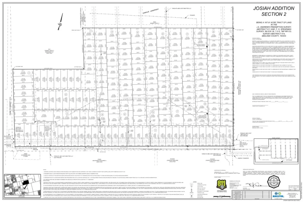
 Josiah Addition Section 2
Boundary and topographic survey plus county plat and variance application for 200 plus one-to-two acre lots along East County Road 150.
View Project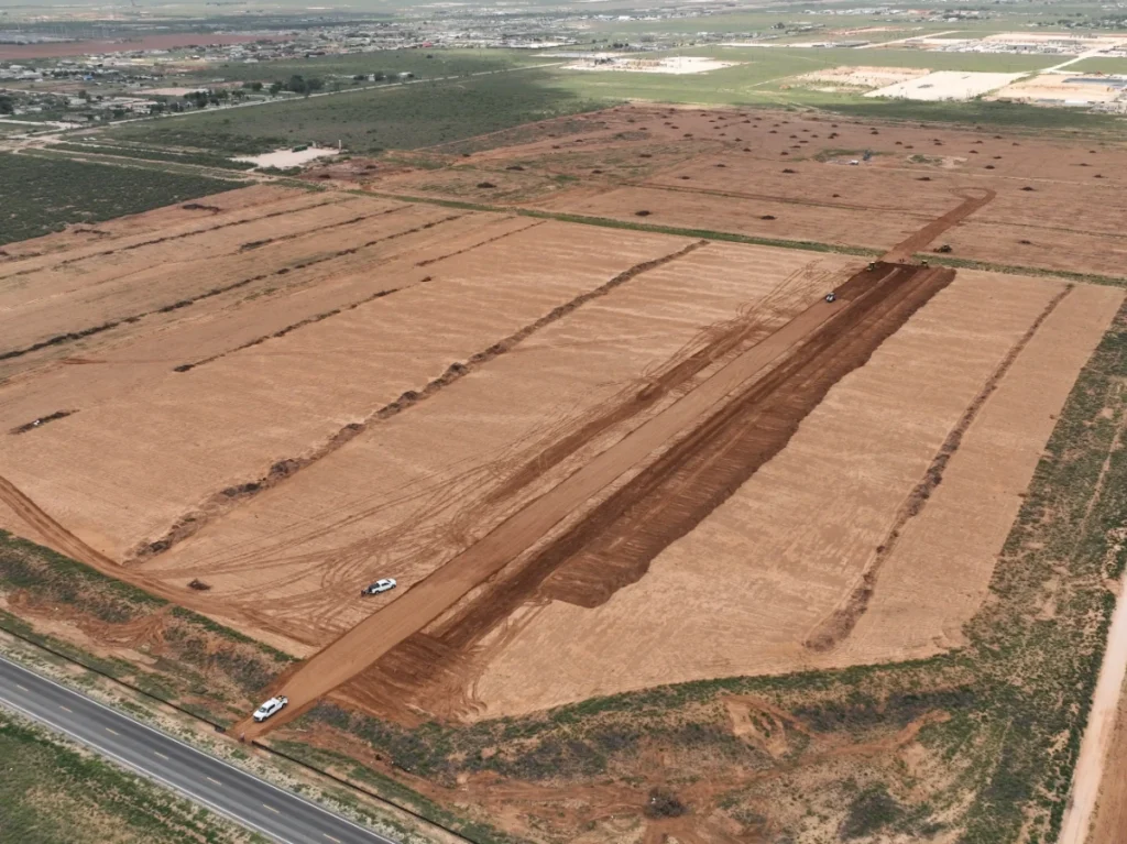 Land Development
 Pony Express Subdivision
Boundary and topographic survey, plat, site and roadway design, drainage, utility coordination, and highway access permitting for 90 plus lots on 97 acres.
View Project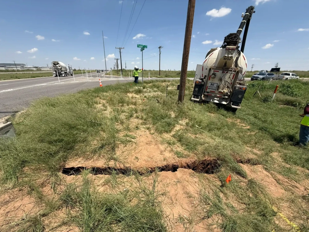 Municipal
 Todd Road Waterline Survey and SUE
Drone and GPS topo plus hydrovac Quality Level A utility locates along a 12,200 foot waterline alignment from Loop 250 to Todd Drive.
View ProjectFrequently Asked Questions
Magrym Consulting provides boundary survey services, topographic, ALTA/NSPS, construction staking, oil and gas pipeline, right-of-way, drone/UAV, and GIS mapping surveys from our Midland, Texas office. We also handle boundary survey for fence placement, lot splits, and rezoning plats for residential and commercial clients. Every deliverable is performed or supervised by an RPLS licensed in Texas.
Yes. Texas law requires that all surveys be performed or directly supervised by a Registered Professional Land Surveyor. Magrym’s team holds active RPLS licensure in Texas, ensuring every plat and deliverable meets legal and regulatory standards. Working with a qualified land surveyor also protects landowners in disputes, transactions, and permitting situations where a legally valid survey is required.
Timelines vary by survey type and complexity. A standard boundary survey for a single lot typically takes 1 to 2 weeks from scope to delivery. ALTA surveys and large pipeline corridor surveys may require 2 to 4 weeks. Contact Magrym Consulting at (432) 684-5548 for a project-specific timeline estimate.
Yes. Magrym Consulting specializes in oil and gas surveys across the Permian Basin, including pipeline right-of-way, well site staking, lease road layout, and facility surveys. Our land surveyor services cover upstream and midstream operators in Texas, New Mexico, Oklahoma, North Dakota, and Colorado.
Yes. Magrym Consulting provides land surveying, civil engineering, and construction services under one roof. Our licensed land surveyor and PE professionals work together so your survey data feeds directly into the engineering design without delays or coordination gaps between firms.
Need a Licensed Land Surveyor?
Contact our Midland office. Our land surveyor team responds promptly and serves clients across the Permian Basin and West Texas.